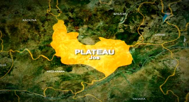
Disruptive rain leading to flooding is expected to continue in parts of Limpopo and Mpumalanga, while thunderstorms can be expected in most provinces.
Boris Jordan Photography/Getty Images
Disruptive rain leading to flooding is expected to continue in parts of Limpopo and Mpumalanga on Tuesday, according to the South African Weather Service (SAWS).
Thunderstorms are expected across most provinces, while damaging winds are forecast between Cape Columbine and Cape Agulhas, which may affect conditions at sea.
Impact-based warnings
Orange Level 4 warning: Disruptive rain with heavy downpours in the northern parts of Limpopo, leading to the flooding of roads, settlements, low-lying bridges/areas, and posing a risk to life.
Yellow Level 2 warning: Disruptive rain in the eastern and western parts of Limpopo, and along the escarpment and Lowveld in Mpumalanga, causing localised flooding, increased travel times, and affecting major roads.
Yellow Level 2 warning: Severe thunderstorms in the central and eastern parts of the North West, central Free State, south-western Gauteng, and extreme south-western Limpopo, leading to localised flooding, hail, damaging winds, and infrastructure damage.
Yellow Level 1 warning: Damaging coastal winds between Cape Columbine and Cape Agulhas, making navigation at sea difficult.
In the SAWS’ colour-coded weather warning system, yellow indicates a moderate risk of impact that requires caution and awareness, while orange indicates that higher-risk impact is expected, requiring increased attention and preparation.
The SAWS uses the numbers to indicate the likelihood of weather-based impacts occurring. Levels 2 and 6 are high, and Level 4 is low. Level 9 is medium.
Advisories
Very hot and uncomfortable conditions are expected over the western parts of the Namakwa Municipal District in the Northern Cape, as well as the west coast, and south-western parts of the Cape Winelands Municipal District in the Western Cape.
The weather in your province
Gauteng: Partly cloudy and cool to warm, with isolated to scattered showers and thundershowers.
Pretoria: 16°C – 23°C
Johannesburg: 16°C – 25°C
Vereeniging: 18°C – 24°C
Mpumalanga: Morning fog patches over the escarpment and Highveld, otherwise cloudy and cold to cool with isolated showers and thundershowers.
Mbombela: 17°C – 20°C
Ermelo: 12°C – 17°C
Emalahleni: 15°C – 22°C
Standerton: 14°C – 21°C
Skukuza: 19°C – 23°C
Limpopo: Cloudy and cool with scattered showers and thundershowers, isolated in the south-east.
Polokwane: 16°C – 21°C
Phalaborwa: 19°C – 22°C
Tzaneen: 17°C – 21°C
Musina: 19°C – 23°C
Lephalale: 18°C – 23°C
Mokopane: 18°C – 24°C
North West: Partly cloudy and warm with scattered showers and thundershowers, isolated in the west.
Klerksdorp: 16°C – 28°C
Potchefstroom: 16°C – 27°C
Mahikeng: 17°C – 25°C
Rustenburg: 18°C – 26°C
Vryburg: 16°C – 31°C
Free State: Morning fog patches in the east, otherwise partly cloudy and warm to hot with scattered showers and thundershowers in the central areas, isolated elsewhere.
Bloemfontein: 15°C – 31°C
Welkom: 17°C – 29°C
Bethlehem: 13°C – 26°C
Northern Cape: Partly cloudy in the east with isolated showers and thundershowers, otherwise fine and hot to very hot, but warm in the north-western parts. Coastal winds will be fresh to strong southerly to south-easterly.
Upington: 19°C – 37°C
Kimberley: 17°C – 33°C
De Aar: 13°C – 31°C
Alexander Bay: 15°C – 26°C
Springbok: 17°C – 35°C
Calvinia: 13°C – 35°C
Sutherland: 8°C – 29°C
Western Cape: Fine and hot to very hot, but cool to warm in the south. Partly cloudy with light rain along the south coast in the evening. Coastal winds will be moderate to fresh southerly to south-easterly, becoming strong to near gale force along the south-west coast in the afternoon.
Cape Town: 17°C – 28°C
Vredendal: 16°C – 39°C
Riversdale: 14°C – 27°C
George: 14°C – 23°C
Worcester: 16°C – 35°C
Beaufort West: 14°C – 31°C
Oudtshoorn: 13°C – 32°C
Western half of the Eastern Cape: Partly cloudy and warm to hot with isolated thunderstorms in the north, fine in the south-west. Coastal winds will be moderate to fresh south-easterly to easterly.
Weather outlook for Monday & Tuesday, 19 – 20 January 2026.
Partly cloudy and cool conditions are expected in the central and eastern parts with isolated to scattered showers & thundershowers. Otherwise, fine & warm to hot but very hot in places. #saws #weatheroutlook #weather pic.twitter.com/VJdSSbsz11— SA Weather Service (@SAWeatherServic) January 17, 2026
Eastern half of the Eastern Cape: Cloudy at first, then partly cloudy and cool with isolated thundershowers, scattered in the north-east. Coastal winds will be moderate to fresh southerly to south-easterly, becoming easterly in the evening.
Gqeberha: 15°C – 25°C
Makhanda: 13°C – 24°C
Cradock: 9°C – 29°C
Graaff-Reinet: 7°C – 28°C
East London: 15°C – 24°C
Port St Johns: 15°C – 25°C
Mthatha: 13°C – 24°C
Komani: 8°C – 26°C
Qonce: 12°C – 25°C
KwaZulu-Natal: Morning fog over the interior, otherwise partly cloudy to cloudy and cool to warm with isolated showers and thundershowers. Coastal winds will be fresh southerly to south-westerly.
Durban: 20°C – 26°C
Richards Bay: 20°C – 25°C
Pietermaritzburg: 14°C – 23°C
Ladysmith: 16°C – 24°C
*This weather report was written with the support of Toqan AI.